Mapping of Seagrass Meadows Aids Conservation
Reviewing: Peng, J., Li, J., Krause, J.R., Lyons, M.B., Murray, N.J., Schill, S.R., Roelfsema, C.M., & Asner, G.P. (2026). Global high-resolution mapping of seagrass to support conservation. Nature 655: 663-669. https://doi.org/10.1038/s41586-026-10704-3
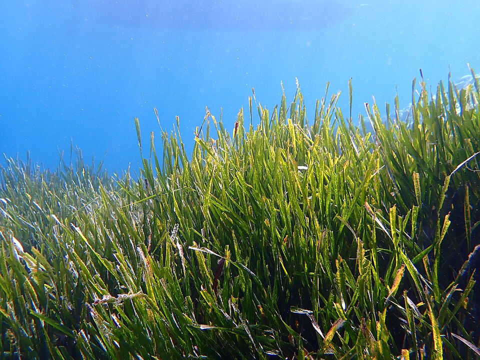
In the age of climate change, some consequences such as severe storms and extreme temperatures are seen and felt physically. Some impacts, though, are harder to visualize from land. One such impact is a reduction in seagrass meadows – an ecosystem present in tropical habitats around the world which provides many critical services including coastal protection, fisheries and biodiversity support, food security, and organic carbon storage (Figure 1). Since 1880, about 19% of surveyed seagrass meadow area has been lost, raising concerns about the amount of organic carbon released into the atmosphere. A higher concentration of organic carbon in the atmosphere contributes to global warming and the negative impacts associated with warming temperatures. Therefore, it is critical to monitor seagrass meadow area and implement practical management solutions to sustain these ecosystems.

Figure 1: Seagrass meadow. Photo credit: Frédéric Ducarme.
Seagrass Mapping
Although seagrass meadow area has been mapped for many decades, it was only recently that researchers began to utilize satellite remote sensing. This method records consistent and frequent observations on seagrass coverage, improving accuracy from previous methods. Increased accuracy is essential for correctly monitoring the health of the seagrass ecosystems and estimating global carbon stocks and sequestration. To ensure the highest possible accuracy, Peng’s team trained two computer models on 195,000 seagrass samples collected from diverse environmental conditions worldwide. The study resulted in the very first global 10-meter resolution analyses of seagrass coverage and distribution in waters shallower than 30 meters. This analysis identifies global hotspots of seagrass loss and gain from 2019-2024, as well as enables national-scale assessments of seagrass area. Together, these data will support the design and implementation of conservation policy and management.
Changes in Seagrass Coverage: Drivers and Implications
Although shallow-water seagrass is present in many regions across the globe, its distribution is uneven with 69% existing in five countries: The Bahamas, Cuba, the United States of America, Australia, and Indonesia (Figure 2).
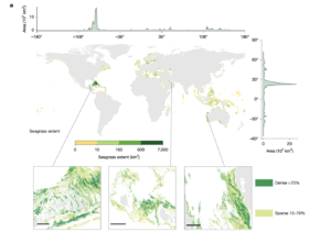
Figure 2: Global seagrass extent 2019-2020 mapped at 10-meter resolution.
Peng’s study determined that, between 2019 and 2024, seagrass experienced a net global loss of 4% – about 1% per year (Figure 3).
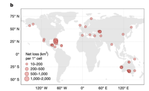
Figure 3: Global seagrass loss 2019-2024. Loss most pronounced in The Bahamas and Australia.
Historically, seagrass losses have been driven by extreme events such as marine heatwaves and hurricanes. However, as anthropogenic threats have accelerated climate change, seagrass loss rates have also increased. Human actions such as coastal development and recreation cause nutrient enrichment, water quality deterioration, and physical modifications to habitat, all of which are leading causes of seagrass loss.
Not only does seagrass loss damage habitat for crustaceans, fish, and a variety of other marine species, but it releases stored organic carbon into the atmosphere. As seagrass ecosystems are degraded, organic carbon stored within the top 30 cm of seafloor sediment is released and contributes to carbon dioxide emissions. Carbon dioxide is a greenhouse gas that majorly contributes to global warming and induces alarming consequences around the world. Therefore, the conservation and management of seagrass meadows is crucial in the fight against climate change and global warming.
Management and Hope
Despite a net global loss of seagrass, there is still reason to be hopeful. Some regions, such as South Bay, USA, and Cuba experienced 52% and 134% net growth, respectively, between 2019 and 2024 (Figure 4). This growth was driven by active management intervention in South Bay, and an intentional decrease in water turbidity in Cuba. Cases such as these demonstrate that conservation policy, intervention, and the natural resilience of seagrass make a positive difference in the species’ ability to thrive.
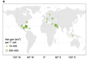
Figure 4: Global seagrass gain 2019-2024. Gain most pronounced in South Bay, USA and Cuba.
When considered amongst various conservation methods, marine protected areas (MPAs) have interestingly not been particularly effective in protecting seagrass meadows. Only ~20% of global seagrass coverage lies within the boundaries of an MPA, as MPAs typically focus more on coral reefs and mangrove forests. However, the importance of seagrass ecosystem has been increasingly recognized, and their locations near reefs and mangroves encourages the possibility of joint, coordinated protection of all these habitats.
Understanding changes in seagrass coverage and distribution has led to acknowledgement of how important these ecosystems are for habitat health and combatting global warming. Peng and his team’s mapping and analyses will contribute to future studies on seagrass change, and data then can be used to prevent further loss, support restoration, and mitigate impacts of climate change.
I am a student in the Master of Oceanography program at the University of Rhode Island and enjoy scuba diving, boating, walking my dogs, reading, and being with friends and family.