There is so much to say about ocean exploration.
The ocean covers 72% of Earth’s surface, and humans have explored 5% of it. Not without purpose either. Ocean exploration has an objective. It is meant to be recorded, organized, and purposeful. Exploration has stemmed from the need for food, land, energy, strategy, technological and medical research, monitoring of natural systems and anthropogenic impacts, and understanding global and planetary systems, among other needs.
Sometimes it makes the news.
Ocean exploration achievements that make the news are only a tiny fraction of the many feats ocean explorers achieve everyday. The big ones, for example, include the discovery of the R.M.S. Titanic and when James Cameron dove 7 miles in his capsule. The ‘news worthy’ stories are sometimes disappointing. For instance, the implosion of ROV Nereus (WHOI) at 10,000 meters during a Pacific Ocean dive. As of December 9, 2015 there is no plan to replace the robot; insurance money collected will fund less risky deep-sea exploration projects (Nature 528, 176–177 (10 December 2015) doi:10.1038/528176a).
YOU CAN DO IT FROM YOUR DESK.
Anyone can explore the ocean without being anywhere near the ocean. All a curious explorer needs is the World Wide Web. Keyword ‘oceanography’ on a search engine can lead to an all day adventure around the globe. The access to live stream data and video is an excellent asset to curious minds of 2016. It is almost overwhelming how plentiful the resources are, one could drown in information.
In many cases the information is all linked into a great sea of data. The trick to a successful expedition is the knowledge of where to find what is sought. An explorer could be searching for peer reviewed journal articles, marine organisms, videos, pictures, live feeds, live chats, tides, real time data, data archives, sample location and descriptions, global sea surface data, and maps, and if they’ve got access to the web then their adventure can begin.
Peer reviewed Journal articles

Scientific publications, particularly the abstracts, and in some cases the entire article, are accessible to explorers who want to do a bit of thoughtful reading. Google Scholar enables a user to search for a keyword and the search engine returns results from peer-reviewed journals. For example, if a curious explorer wanted to learn about the latest published work on blue whales in the southern hemisphere, they could type ‘blue whales southern hemisphere’ into the search bar, adjust search specifications and in an instant they will have list of relevant articles (figure 1). If there is a link in the right column then the entire paper may be downloaded. Often times users are able to access more full articles at a university as oppose to their private internet unless they are subscribed to the source sites.
Marine Organisms

The World Register of Marine Species is a great way to explore the critters living in sea. Upon a visit to World Register of Marine Species one could choose to search by distribution, name, collector, or literature, to name a few. For example, a distribution search of the Mediterranean Sea geographical area, returned 1783 results for biological kingdoms. Each of the near 2000 results linked to information regarding classification, the source of the original description, the citation for the information, etc. Searches for taxa are by the scientific name, common name, aphialD, ITIS TSN, or authority. After searching for the common name, star-fish, information on the scientific names, sources, distribution, additional links to information, and its status was all available (figure 2).
Tides/Coasts
An explorer who is interested in tides, currents, and coastal processes can explore in real time! NOAA tides and currents site lists various port stations. By selecting Potter Cove in RI information on real time wind speed and direction in Narragansett Bay is mapped (figure 3). Any curious explorers interested in watching the sea surface temperature in Washington D.C. change during the latest Blizzard were in luck because NOAA also allows access to real time sea surface from stations up and down the coasts and on the Great Lakes (figure 4). NOAA also has a program called NowCoast with real time coastal observations, forecasts, and warnings (figure 5).


(http://tidesandcurrents.noaa.gov/cdata/StationList?type=Current+Data&filter=active)

Data Archives/Real Time Data/Maps/ Sample locations/Descriptions
Data derived from fieldwork is always so intriguing to explore! So much of this information is linked through web portals.

A fun place to start is with GeoMapApp hosted by Marine Geoscience Data System at Lamont-Doherty Earth Observatory of Columbia University It is an application which enables an explorer to view data surveys, some over 50 years old! A range of information is available from earthquake data to photographs taken during deep-water dives. In the application users are able to choose from various data layers including oceanography, geology, geochemistry, human impacts, remote sensing, planets and moons, climatology. Figure 6 is an example of the exploring done by choosing the oceanography data layer and then water column properties, and loading the World dataset of Temperature Salinity Oxygen Nutrient Profiles (Reid and Mantyla 1994). From there links to the water column at stations all over the map become accessible.

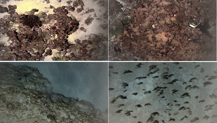
The geology data layer will lead explorers to the Marine Geoscience Data System (MGDS) The MGDS site is really great in itself. For example, it enables the exploration of data from ALVIN dives such as transition metal data from AT15-13 November 2006 (figure 7) {(Bryce, Julie, Prado, Florencia, & Von Damm, Karen. (2015). Fluid Transition Metals Particulates from Atlantis Expedition AT15-13 (2006). Integrated Earth Data Applications (IEDA). http://doi.org/10.1594/IEDA/321741)} The data was easily found by choosing the vessel and PI in the Data portal. It linked to various resources, more data, and citation information.
GeoMapApp also has a section called GeoMapApp at sea that links to 12 different research vessels’ websites. From those explorers can read about current and old expeditions of the vessel, learn about the vessel specifications, view videos, currents tracks, and access sea data (figure 8).

Ocean Tracking Network allows the exploration of current ocean conditions via buoys deployed globally (figure 9).
NOAA, which has a great resource to explore interesting ocean facts about biology, geology, ocean management, and also links to additional resources. For instance, the Global Change Master Directory (GCMD). This site allows explorers to search for datasets like those from the International ocean drilling program (IODP) (figure 10).

NOAA also has a resource called the National Centers for Environmental Information. At this site on January 22, 2016 65,348 results for marine datasets were returned (figure 11). Exploring the datasets further leads to available .html and .csv files, and other resources such as abstracts, contacts, and recent activity if applicable. There are also search specifications like limiting the results to specific formats and tags, and there is opportunity to search by dive number, location, or keyword! From the National Center for Environmental Information site explorers can also access the ‘Index to Marine & Lacustrine Geological Samples’. This provides a map view of core samples collected globally and marks them based on their storage location (figure 12). By selecting a sample, an explorer can gain information about the core, such as, vessel, cruise, description, the curators contact information, length, diameter, how it is stored, and the type of core.


Live Chats, Videos, Pictures
Nautilis Live is really neat site that has live feed with onboard scientists exploring at sea! When the vessel is actively exploring the public can watch and chat live! When the ship is at port the videos and photos are still available to explore.
Additional Resources
Kwsnet.com is an annotated subject directory for the web. It is very simple to use, just type a search word in the search box, like ‘oceanography’ and it returns indexes, like resource index and a marine school index (figure 13), that contain links to sites that are helpful to exploring the sea that may not have come up on your initial basic web oceanography search!

Of course there are other way to explore as well.
Go Outside!
Exploration can take place outside too! The most direct way to explore is the hit the coast during low tide—if may be a little smelly, but flip over a few rocks and see what scurries away! Or from a coastal cliff, check out the patterns of wave refraction as they approach the shore. If the water is warm enough, snorkel, it is s a great way to explore the shallow water ecosystems! For a deeper insight get your SCUBA certification or jump aboard a submarine. Always remember, when you explore, be mindful of the environment!
Stay inside, but offline!

Maybe you want to get off of the web but you cannot access the ocean. Consider reading Water Baby: the story of ALVIN by Victoria A. Kaharl (Figure 14). The book is a 1990 publication about the history of the submersible ALVIN, the world’s first deep-diving submarine explorer.
Exploration is important and fun, so try it out for yourself, and remember to always cite your sources!
Hello, welcome to Oceanbites! My name is Annie, I’m a marine research scientist who has been lucky to have had many roles in my neophyte career, including graduate student, laboratory technician, research associate, and adjunct faculty. Research topics I’ve been involved with are paleoceanographic nutrient cycling, lake and marine geochemistry, biological oceanography, and exploration. My favorite job as a scientist is working in the laboratory and the field because I love interacting with my research! Some of my favorite field memories are diving 3000-m in ALVIN in 2014, getting to drive Jason while he was on the seafloor in 2017, and learning how to generate high resolution bathymetric maps during a hydrographic field course in 2019!